
BinacoBinaco
Mail to us
+971 2872 8014
8am - 5pm
Abu Dhabi , UAE

Mining & Quarry Mapping

Overview

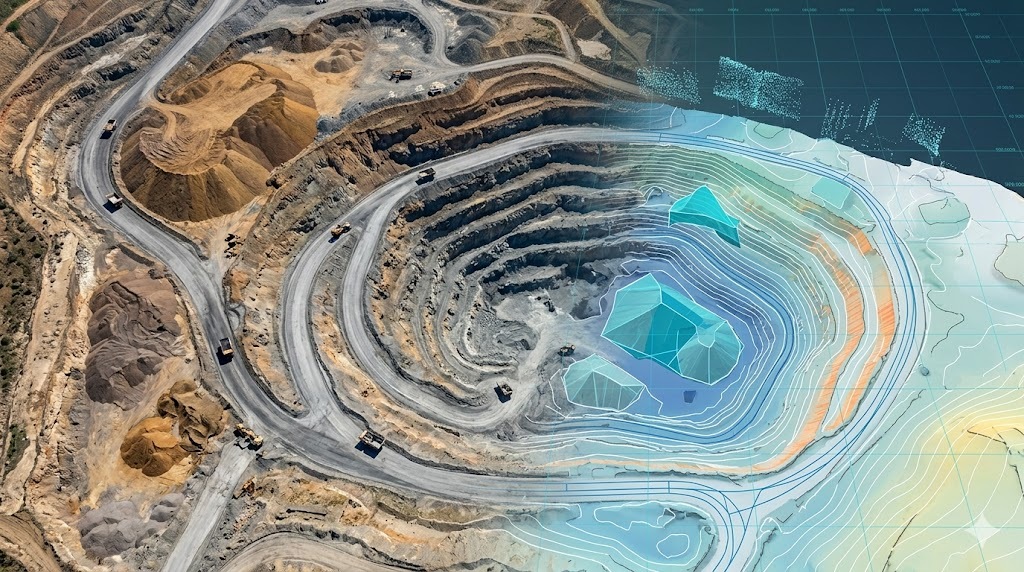
Mining and quarry mapping using Scan to BIM provides precise digital models of excavation sites, stockpiles, and terrain conditions for efficient resource extraction and site management. By converting high-resolution scan data into structured models, mining engineers and surveyors can monitor site progress, calculate material volumes, and plan operations with greater accuracy. This approach improves safety, reduces operational risks, and ensures optimized utilization of mining resources through reliable spatial data.
Key Capabilities

Accurate Scan to BIM solutions for mining operations, quarry analysis, and material management workflows.

Quarry Surface Modeling

Create precise digital models of quarry pits and excavation surfaces.

Scan to BIM Conversion

Transform point cloud data into structured mining-ready models.

Stockpile Volume Analysis

Calculate accurate material volumes for inventory and reporting.

Progress Monitoring Support

Track excavation changes and site development over time.

Slope & Stability Mapping

Provide spatial data for assessing terrain safety and stability risks.

Resource Optimization Planning

Support efficient extraction and site operation strategies.

work process

Our Working Process

Project Requirement Review

We define mining objectives and collect site and operational details.
01

Site Scanning & Data Capture

High-precision scanning captures quarry terrain and stockpile data.
02

Point Cloud Processing

Captured data is processed into structured models and datasets.
03

Modeling & Analysis Delivery

Final outputs are delivered for mining analysis and operational use.
04

Our Deliverables

We provide a complete set of deliverables to support project planning, design, and execution.

Mining BIM Models

Accurate digital models of quarry sites, pits, and excavation areas.

Point Cloud Data Sets

High-density spatial data for analysis and operational planning workflows.

Volume Calculation Reports

Precise material quantity measurements for stockpiles and excavation zones.

Terrain & Surface Models

Detailed models of quarry surfaces for planning and safety analysis.

Progress Monitoring Reports

Comparative data showing site changes over time for tracking operations.

Geospatial Mining Data Files

Structured datasets compatible with CAD, GIS, and mining systems.

Have you Any Question?

It provides accurate models for planning, monitoring, and resource management.
Yes, scanning delivers highly accurate and reliable volume calculations.
Yes, it helps assess slopes and terrain stability risks effectively.
Data is provided in BIM, CAD, and geospatial-compatible formats.